Sand, Stone & Splendour
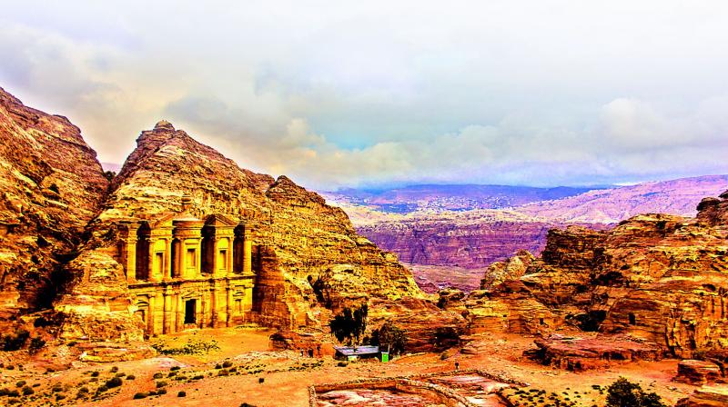
The enchanting topography of Petra makes its monuments even more striking.

I keep walking through the narrow slit in the canyon. The light is barely able to reach the ground. The rugged rock face is stunning, but seems like it's closing upon me. I begin to feel queasy, but a few seconds later, I see massive stone columns peering out from the crevice. Soon, I am face to face with one of the Seven Wonders of the World.

I am in Petra, an ancient city and grand necropolis in southern Jordan. The Nabateans, a nomadic Arab community, came to the region in the 6th Century BCE. They monopolised trade routes and became prosperous. In the 1st Century BCE, Petra, their capital, became an important outpost on the spice trade that stretched from India and China to Rome.
The Nabateans have left behind tombs, altars, roadways, aqueducts and reservoirs — all carved out of pink sandstone. To see these archaeological marvels, one must pass through a 1.2-km-long path known as the Siq. Although commonly referred to as a canyon, it is a geological fault line — a single block of rock was torn apart by tectonic shifts. The walls have niches, which must have once contained idols of Dashara, the primary Nabatean deity, and a few carvings. A conduit, which supplied water to the city, is hewn into the rock. It is still clearly visible along most of the Siq, as are the remains of the two-millennia-old terracotta pipes. It is this mastery of hydraulic engineering that helped the Nabateans raise a thriving civilisation in an inhospitable terrain.
After walking through the constricted confines of the Siq, I am disoriented by the bright sunshine. The path opens out to Al Khazneh (the Treasury). The Nabateans could not have chosen a better location — the hike through the Siq builds immense anticipation and when one is least expecting it, the façade comes into view. Like all Nabatean structures, it has not been built, but hewn out of the rock face. The two-tiered building with Corinthian columns, pediments and a central tholos bears marked Hellenistic influences. The eroded carvings on the structure suggest that it must have once borne several sculptures.
Further ahead, a steep 30-minute climb takes you to the High Place of Sacrifice, the most well-known of Petra’s ‘high places’ — mountain tops where religious rituals and sacrifices were conducted. Just before the summit, there are two seven-foot-high rock obelisks. It must have been quite the feat to chisel them out of the mountain. At the apex, there is a platform fronted by altars, up to which steps have been constructed. One has a circular basin attached to a drain, indicating that it was used for blood sacrifices. What the Nabateans did here is largely conjecture as none of the shrines bear inscriptions and there are few historical records. Regardless, it a great vantage point to enjoy the multifarious hues of Petra's landforms.
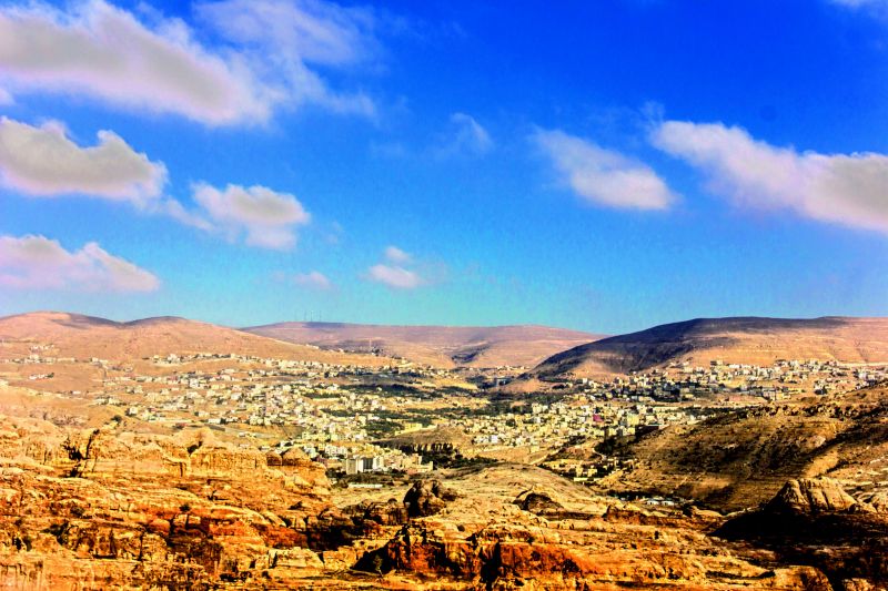
The ethereal landscape is the perfect setting for the grand yet austere monuments. The pink sandstone changes colours with the mood of the sunlight, appearing golden, mauve or rosy at different times of the day. The hills are incredibly craggy, as if an impetuous child had scrawled all over them. Millions of years ago, the country that we today call Jordan was underan ocean. As sand and other particles accumulated at the bottom, owing to the immense pressure, the sediments eventually compacted and lithified into rock. Sand dunes move relatively swiftly and consequently, one can see the different layers of sand as stripes in the rocks. Over time, the wetness of the dew and rain combined with strong winds and the heat of the desert sun to create a powerful erosive effect, giving the hills their present contour. The erosion has also laid bare the striated patterns in the rocks.
I was at Petra for two days, which is just about enough to explore the highlights. There are more than 800 monuments in the archaeological site spread over an expanse of 2,640 acres, of which only one-twentieth has been unearthed! Motorised vehicles are not allowed, necessitating long — and often uphill — walks between the various landmarks. Carriages can be hired up to the Treasury and beyond that, you can saddle on a donkey. I mostly walked as I found the leisurely pace apt for soaking in the splendour of the landscape. I did burden a beast once after a Bedouin followed me for a kilometre, peppering his hard sell for a donkey ride with Hindi words. (The sole legacy left behind by Indian tourists seems to be gadha and jaldi jaldi!)
Whether you travel on foot or on the back of another creature, it is hard not to be awestruck by the sheer scale of the ruins and the ingenuity of the Nabateans. Petra flourished even after the Romans took control in 106 CE. At its peak, it was home to 20,000-30,000 people. However, after the trade was routed through Palmyra and the Arabian Peninsula, the kingdom’s fortunes began to wane. A series of earthquakes and possibly, catastrophic floods hastened its decline.
At some point, perhaps the 4th Century CE, the Nabateans mysteriously abandoned Petra. We do not know the reason, but the dearth of silver coins and valuables in archaeological remains suggests that the migration was systematic and unrushed. All that was left behind were the grand structures, most of which were buried under layers of sand and debris brought in by flash floods over the centuries. The city remained obscured, except to the local Bedouins, until Bruckhardt, a Swiss explorer, visited it in1812. Today, the “extraordinary impression” he had of the city resonates with every visitor as they walk out of the “gloomy and almost subterraneous passage” of the Siq.

