Now You See It, Now You Don’t Monsoon Has Centre on Tenterhooks

With the monsoon yet to cover all of India, a sense of urgency appears to have now set in with the Centre taking stock of agricultural operations and preparedness during this year’s Kharif crop season.
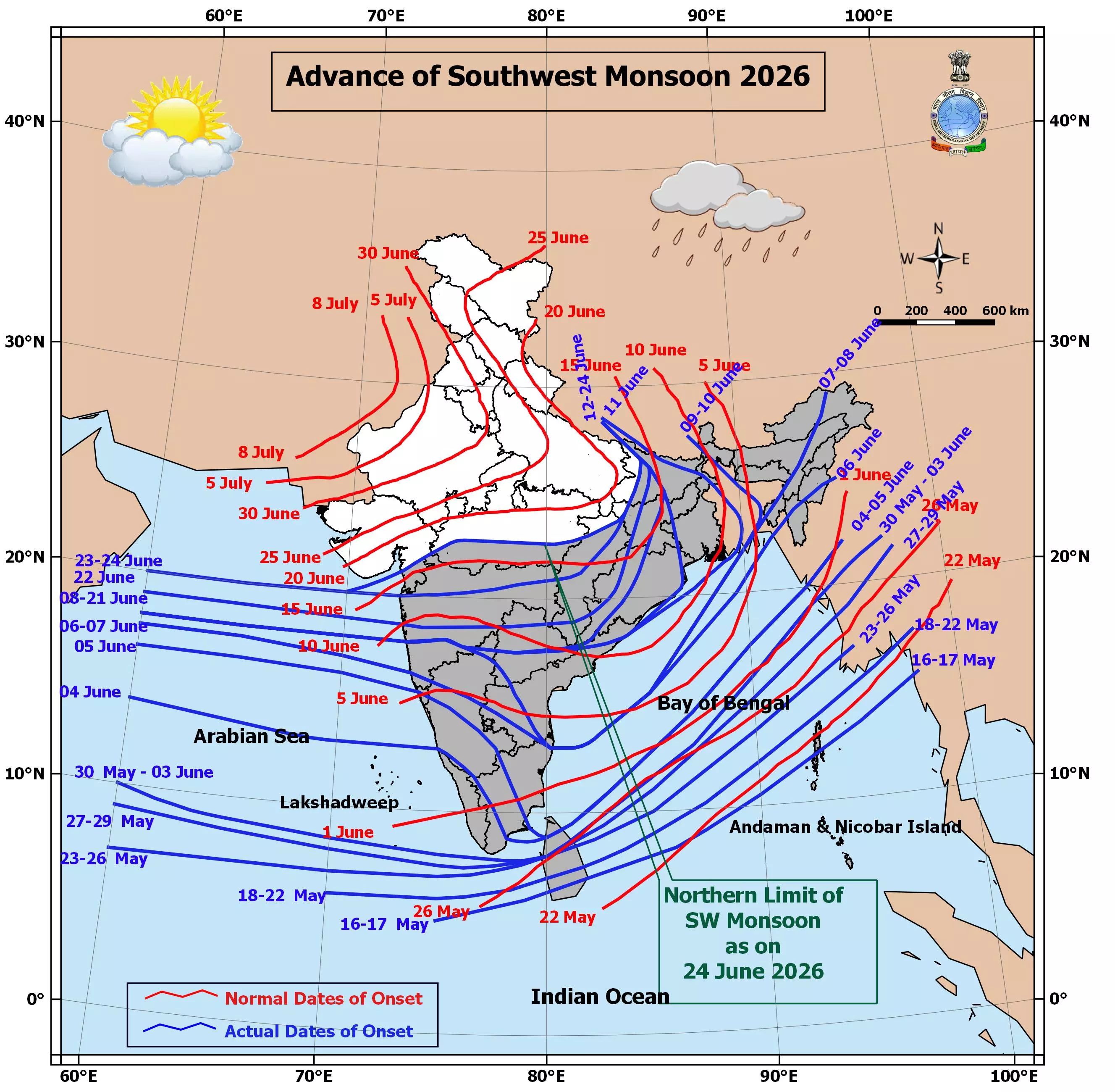
Hyderabad: The southwest monsoon season this year, with its sputtering progress across India, is likely to see a pause in July with prospects of further rain under a cloud in August and September.
With the monsoon yet to cover all of India, a sense of urgency appears to have now set in with the Centre taking stock of agricultural operations and preparedness during this year’s Kharif crop season.
That the situation is getting dire was reinforced by Union agriculture minister Shivraj Singh Chauhan who on Tuesday said, “We are preparing in advance, not waiting for a crisis,” when he announced that the Centre had identified 315 districts as vulnerable. Of these, 111 have been listed as high priority as they have very little in terms of irrigation. Chauhan was speaking after a meeting with agriculture ministers of different states.
Most of these identified districts are in Madhya Pradesh, Maharashtra, Gujarat, Uttar Pradesh, Rajasthan, Karnataka, Bihar, Jharkhand, Telangana, Andhra Pradesh and Odisha. In fact, Telangana, the largest rice producer in India with 152 lakh metric tonnes (LMT) in the 2025-26 crop year, has been pushing farmers hard to switch to rainfed crops because of the poor monsoon.
The India Meteorological Department (IMD) had previously announced a below-par southwest monsoon, saying that this year’s rainfall would be just 90 per cent of the 50-year long-period average (LPA) of 870 mm for the country as a result of the ‘super’ El Nino forming in the Central Pacific Ocean, referring to the warming of the waters that affects the Indian monsoon.
The El Nino’s impact was expected by meteorologists to result in around 14 per cent deficit in June but the figure has been surpassed multifold with India currently down 43 per cent of its average rain so far. Rainfall for the rest of the season too does not bode well as things stand now.
According to the Central Water Commission, the total storage across all reservoirs in India, as per its last assessment on June 16, was 1,782.09 thousand million cubic feet (tmc ft), against the full capacity of 6,486 tmc ft, a fall from 2,078.2 tmc ft for the same date last year. What this means in essence is that with this year's poor rainfall, the water currently in the reservoirs, with possible modest additions, will have to be managed not just till the onset of next year's monsoon, but until the rivers begin flowing properly again and start refilling the reservoirs.
The onset of the rain over parts of Maharashtra, with downpours over Mumbai making news currently, might well be just a passing phase. When the season comes to a close, even parts of Tamil Nadu and Karnataka will end up with deficit rainfall, meteorologists said.
However, the eastern coastal states, and even parts of Telangana, Andhra Pradesh, south interior Karnataka, Tamil Nadu and Kerala, are expected to get a breather when the monsoon begins its retreat at the end of September. setting in motion the northeast monsoon season which typically brings good rains to these regions.
According to Dr Akshay Deoras, research scientist at the National Centre for Atmospheric Science & Department of Meteorology, University of Reading, UK, what could happen is that the monsoon would weaken sometime in July with the second half of the month being drier than its first half. “The question is whether the breaks between the rain spells will be short or long. Typically, such breaks last for five days, sometimes even up to 10. How long the breaks will determine how much impact there will be on agriculture, and all India rain numbers,” Dr Deoras said.
The only parts of India to escape the wrath of an El Nino-hit monsoon are expected to be the some regions in northern Jammu and Kashmir and much of Ladakh, as well as whole of Arunachal Pradesh, much of Assam east of Dispur, and Nagaland, where the rain was forecast to be above normal. Most other states, including Delhi, Haryana, Punjab, Bihar, Madhya Pradesh, Rajasthan, Gujarat, Maharashtra, Odisha, Karnataka, Telangana, Chhattisgarh, Jharkhand, Uttarakhand, and Uttar Pradesh were expected to suffer deficits.
At present, the Indian Ocean Dipole (IOD) — seen as an antidote to the El Nino havoc — turning positive is a hope, but uncertainties being predicted by the Indian National Centre for Ocean Information Services (Incois) which has said that the current El Nino conditions are expected to last into February 2027. This may cast a long shadow on the southwest monsoon season next year too, even as the country is grappling with the vagaries of the current monsoon season.
According to Dr Deoras, weather models indicate that the current El Nino will begin weakening this November. “Though it may take a few months to disappear, in the past, as in 2016 and in 2023, we saw strong El Ninos followed by strong La Nina formations which are good for the Indian monsoon. How the 2027 monsoon may turnout is too early to say but the next year is expected to be warmer globally,” he said.
Where’s the rain
Expected rain till June 24: 119.9 mm
Actual rainfall till June 24: 70 mm
Departure from normal: Minus -41.6%
Long period average for June: 165.3 mm
Cumulative rainfall in June 2025: 180 mm
Reservoir levels low
Total national reservoir storage 6846 tmc ft*
Storage on June 16, 2025: 2078 tmc ft
Storage as on June 16, 2026: 1,782.09 tmc ft
* tmc ft refers to thousand million cubic feet of water, roughly 29 billion litres of water.