Africa Gets Bigger, North America And Europe Shrink On Maps

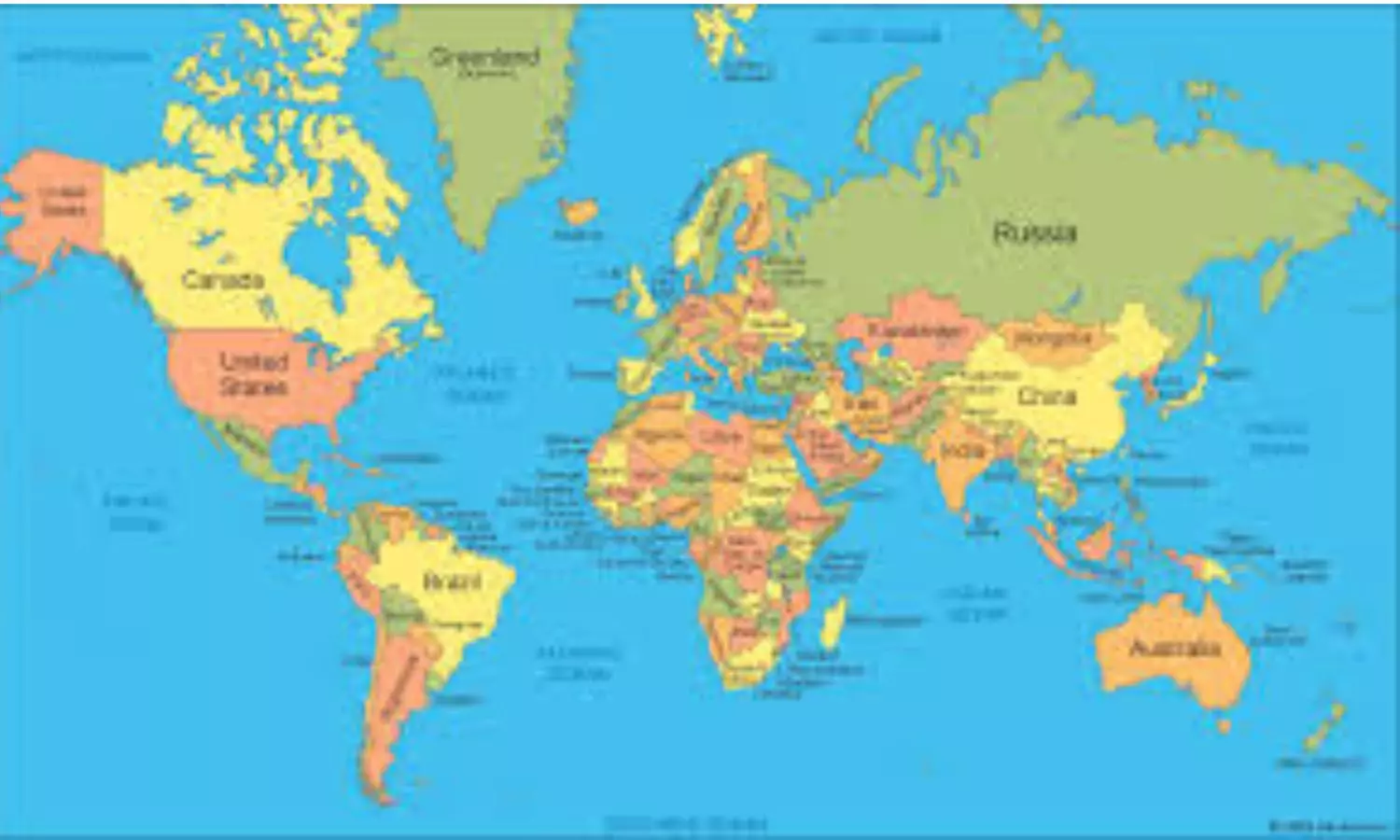
The resolution, 'Correct the map: rebalancing global cartographic representation and promoting equitable representation of the world's regions, particularly Africa', promotes map projections that more accurately reflect the true size of continents. It was the culmination of an African-led campaign against the 16th-century Mercator projection, still the most widely used map in the world
New Delhi: India was among the 164 countries that on Friday voted in favour of a resolution in the United Nations to correct the traditional world map and adopt a new global cartographic representation that makes the African continent bigger while shrinking North America and Europe on maps. The resolution, sponsored by Togo, got 164 votes in favour, with abstentions from Estonia, Georgia, Lithuania, Moldova, Serbia and Ukraine, and a lone vote against from the United States of America (USA). The US dismissed the initiative as part of a “radical ideological project.”
The resolution, 'Correct the map: rebalancing global cartographic representation and promoting equitable representation of the world's regions, particularly Africa', promotes map projections that more accurately reflect the true size of continents. It was the culmination of an African-led campaign against the 16th-century Mercator projection, still the most widely used map in the world.
“Maps shape our understanding of the world. They guide education, nourish the imagination, and influence collective perceptions…A fair map does not change the geography of the world, it changes how we see the world,” said Robert Dussey, Togo’s foreign minister, before the vote.
The resolution noted that the Mercator projection, designed in the 16th century for navigational purposes, remains widely used in educational, media, digital and official materials, despite the considerable distortion of landmasses to the North and South, far from the equator. The resolution noted that "this distortion contributes to minimising the perceived sizes of Africa, Latin America and South Asia, and perpetuating an unbalanced view of the world."
However, the resolution does not ban the Mercator projection or impose a replacement. Instead, it encourages governments, schools, international organizations and technology companies to use the Equal Earth projection and other so-called equal-area maps when relative size matters, and to teach the limitations of any flat map in representing a spherical planet.
In an explanation of the vote in the General Assembly, First Secretary at the Permanent Mission of India to the UN, Mr Raghoo Puri, said India welcomes the intention behind the resolution to promote more accurate and representative cartographic practices.
"We believe that maps play an important role in how societies understand geography and the relative scale of the world around us," he said. However, India clarified its understanding of the scope of this resolution, saying, "We believe that the resolution should be understood as supporting the broader use and consideration of Equal Area map projections, and not as endorsing the Equal Earth projection or any other specific map projection."
Equal Area projections are particularly relevant because they preserve the relative sizes or areas of continental and territorial landmasses, Mr Puri said. "This can help address distortions in perceived landmass size that arise from projections designed primarily to preserve other geographic characteristics such as shape, direction, or distance. At the same time, different projections serve different cartographic purposes. No single projection is necessarily appropriate for every application. Therefore, we believe it is important for this resolution to remain technological and methodological-neutral. Our delegation supports the language that encourages accurate cartographic representation while allowing countries, institutions and cartographers to determine which projection is most appropriate for their specific needs," Mr Puri said.
He added that India's position is limited to the principle of encouraging Equal Area approaches where the objective is to preserve the relative sizes of continental landmasses.
"Such an approach would preserve the resolution's objective while avoiding all unnecessary preference for one particular cartographic methodology or endorsement of any specific projection, including the Equal Earth projection. India has therefore voted in favour of this resolution," he said.
France, which co-sponsored the resolution in support of the new map, announced that it would abandon the Mercator projection. In that map, "the United States, Russia and China take on a disproportionate visual prominence compared to Africa, Latin America or southeast Asia," while "Greenland appears almost as big as Africa," Foreign Minister Jean-Noel Barrot said.
Ukraine said it supported efforts to correct historical distortions affecting Africa and other parts of the Global South but objected to the way some maps using Equal Earth depict Ukrainian territory occupied by Russia.