INSAT-3DS Captures 1,600-km Thunderstorm Belt From Rajasthan To Telangana

The satellite imagery reveals dense cloud clusters over Rajasthan, Madhya Pradesh, Maharashtra, Telangana, Chhattisgarh, Odisha, West Bengal, Jharkhand and parts of southern India.
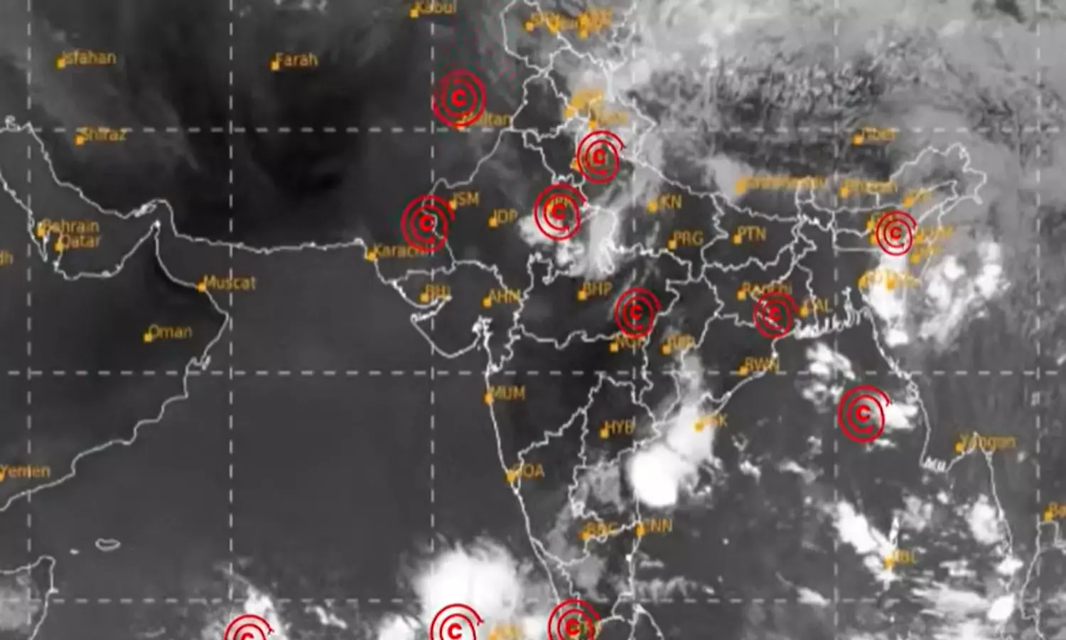
A massive band of thunderstorms stretching nearly 1,600 km across India was captured by the India Meteorological Department’s INSAT-3DS satellite on Monday evening, indicating pre-monsoon activity.
The latest thermal infrared imagery shows a nearly continuous corridor of towering thunderclouds extending from western Rajasthan near Jodhpur, through central India, down to Telangana and Hyderabad. Dense cloud clusters are visible over Rajasthan, Madhya Pradesh, Maharashtra, Chhattisgarh, Odisha, West Bengal, Jharkhand and parts of southern India.
A separate extensive cloud shield remains spread across the Himalayan region. Meteorologists estimate that 70-80 per cent of India is currently witnessing some form of thunderstorm or pre-monsoon cloud activity, an unusually widespread pattern for this time of year.