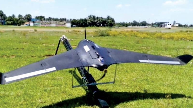
10 UAVs ready to be deployed for monitoring water bodies
The heavy rain and excess discharge of water from lakes and reservoirs in Chennai submerged almost the entire city last December.

Chennai: The Centre for Aerospace Research in MIT campus of Anna University has developed 10 Unmanned Aerial Vehicles (UAVs) which are ready to be deployed during this monsoon season to monitor water bodies in and around Chennai.
The heavy rain and excess discharge of water from lakes and reservoirs in Chennai submerged almost the entire city last December. The police had then used drones to gather information on stranded residents and to rescue them.
Under the Tamil Nadu Innovation Initiative (TANII) by the State Planning Commission, new UAVs with fixed wings have been developed by the Centre for Aerospace Research. Now, the government of Tamil Nadu and Anna University is planning to monitor the water bodies using these UAVs. Depending upon the need, they will monitor big reservoirs and lakes in Chennai, Kancheepuram and Tiruvallur districts.
“Drones or UAVs are capable of acquiring high-resolution aerial images at low cost. Unlike the satellite images which can give the resolution in metres, these UAVs can give high-resolution images with accuracy upto 6 centimetres. ,” said K. Senthil Kumar, director, Centre for Aerospace Research.
“So far we have developed 10 UAVs and also trained many people, including police personnel on operating these vehicles,” he said. The vehicle can be launched using the launcher and it has an inbuilt parachute which will help it to land safely.
Compared to UAVs using rotary wings, these fixed-wing UAVs can fly over larger areas with relatively good speed as it is equipped with light-weight digital cameras. “It can fly from 1 hour to a maximum of 6 hours depending on the need.
We have already test-flown the vehicle capturing the images of Padappai lake. By using the UAV-based Photogrammetry, we have acquired the digital surface model of the lake,” he said. “Employing the digital elevation model we even identified a block on the water canal of the lake and we informed about it to the district administration,” he added.
Discussions are also on to use the UAVs for mapping of natural resources and riverbeds in the state. “The application side of UAVs is endless like environmental monitoring, agriculture management, disaster relief, city planning and crop insurance. We also are exploring opportunities, whether it can be used for cadastral mapping for establishing the ownership of lands,” he said.

