Damming Kollidam
Fast forward to Kollidam as a flood carrier, it was in 2005, the river last carried more than three lakh cusecs when there was flood.

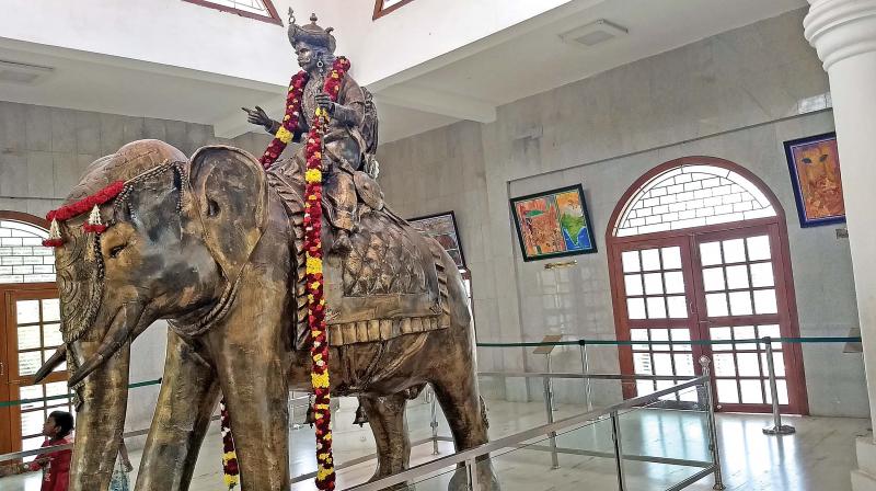
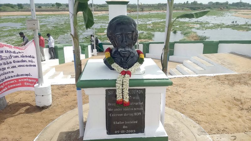
Thanjavur: “Cauvery perukeduthal kollumidam Kollidam”-so goes a popular Tamil film song. This means when Cauvery surpluses, Kollidam (Coleroon) takes the floods. Grand Anicut constructed by Karikal Cholan in 2CE also envisaged Kollidam as a flood carrier and regulated the irrigation in Cauvery delta through Cauvery and Vennar systems. Later, British engineers added Grand Anicut (GA) canal as a man-made canal under Mettur project. Sir Arthur Cotton, a British engineer, upgraded by designing and structuring the under sluices of Kollidam in 1839. State government installed a bust of Arthur Cotton at Grand Anicut in 2005.He also constructed Upper Anicut dam at Mukkombu near Tiruchy based on the model of Grand Anicut.
Fast forward to Kollidam as a flood carrier, it was in 2005, the river last carried more than three lakh cusecs when there was flood. Again after 13 years , now it carried more than two lakh cusecs. But in 2005, it was due to northeast monsoon and Kollidam was in spate in the last week of October. This surplus is from southwest monsoon battering Kerala and Cauvery’s catchment areas and the river has been carrying more than two lakh cusecs for the past four or five days.
 Bust of Sir Arthur Cotton, British engineer, who designed and structured the under sluices of Coleroon in 1839 at Grand Anicut. (Image: DC)
An irony this year is, even as Kollidam is in spate, demand for water for taking up cultivation is coming from various parts of Cauvery delta. Even as people gather at various points alongside Kollidam to look at the floods, farmers in the Cauvery delta area have been agitating at different places demanding water for cultivation as water released into Cauvery, Vennar and GA canal has not yet reached tail-end areas, they aver.
They are also anguished over large quantity of water drained into sea by Kollidam river. “Water should not go waste. That too in a surplus year we should save water,” they say. A total of 12,000 cusecs make one tmcft of water and if two lakh cusecs is released into Kollidam it works out to 16 tmcft. In the last four or five days 80 tmcft has been “wasted” into sea. In normal years, 20 tmcft to 25 tmcft will be wasted into sea according to PWD engineers as it cannot be saved and as only a maximum of 25,000 to 30,000 cusecs alone can be released into Cauvery, Vennar and Grand Anicut canal systems.
The engineers further say that Cauvery and Vennar can take a maximum of 12,000 cusecs only while Grand Anicut canal can take a maximum of 3,500 to 4,000 cusecs only.
Kollidam as a flood carrier can take a maximum of four lakh cusecs. (cusecs is unit flow i.e. one cubic foot per second. This works out to 28.317 litres per second).
Kollidam as a flood carrier has proved its utility time and again. But is it possible to save surplus water let into Kollidam? Are barrages possible to save water in Kollidam river? “Yes, it is definitely possible.” says Mannargudi S..Ranganathan, secretary, Cauvery delta farmers welfare association.
He also categorically refuted the statement of Chief Minister Edappadi K. Palaniswami that barrages are not possible on Kollidam.
Kollidam, which runs to a length of 168 kms and has a width of 1.8-km branches at Mukkombu to form the Srirangam island and again at Grand Anicut to travel towards east to enter Bay of Bengal at a place near Kollidam near Sirkazhi in Nagapattiam district.
Lower Anicut across Kollidam is at Anaikarai, 20-km from Kumbakonam. The one-km long bridge connects Kumbakonam with Chennai and other northern towns. Gangaikonda Cholapuram, which has a temple built by King Rajendra Cholan, son of Raja Raja Cholan, is 10-km from Anaikarai. Kollidam river is the source for many drinking water projects, particularly combined water schemes.
Its northern and southern banks form the borders of Ariyalur, Cuddalore, Thanjavur, and Nagapattinam districts.

