Isro takes one step closer to giving India its own GPS

SRIHARIKOTA: After facing unexpected setbacks and delays in putting up the Indian Regional Navigation Satellite System (IRNSS) or Navigation with Indian Constellation (NavIC), the Indian Space Research Organisation completed constellation of satellites by successfully launching the backup satellite IRNSS-1I on Thursday thus moving a step closer to having India’s own GPS.
Apart from providing position-based services, the indigenous constellation will help the various industries including the fishermen, merchant ships, transport operators, traffic management, tracking train’s movement and alerting the road users at unmanned level crossings, land survey, port operations, agriculture and disaster management. It will also be extremely useful to the armed forces during the time of conflicts.
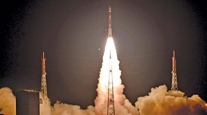
Following the 32 hour countdown, the PSLV-C41 carrying IRNSS-1I satellite blasted off from the first launch pad of Satish Dhawan Space Centre in Sriharikota at 4.04 am on Thursday.
After a flight of about 20 minutes, the rocket has placed the navigation satellite Sub-Geosynchronous Transfer Orbit with the perigee of 281.5 km and apogee of 20,730 km. Subsequently, the satellite will be taken to geosynchronous orbit at the height of 36,000 km through four orbit raising operations.
Speaking after the launch, Isro chairman K. Sivan gave a call to
the industries and academic institutions to make use of the NavIC (Navigation with Indian Constellation) for bringing out several innovative applications to help the common man.“With this launch, the first phase of Navic constellation is completed. The applications of this particular constellation for providing position-based services started. We should make use of the constellation to ensure that underprivileged and unreached people also getting position based services,” Isro chairman Sivan told reporters after the launch.IRNSS-1I is the latest member of the ‘Navigation with Indian Constellation (NavIC)’ system.
NavIC, also known as Indian Regional Navigation Satellite System (IRNSS), is an independent regional navigation satellite system designed to provide position information in the Indian region and 1500 km around the Indian mainland.
Isro is also planning to launch the second phase of navigation satellites. It is expected to have seven satellites. “We are preparing the proposal for the next phase. The navigation satellites will have advanced technologies and indigenous atomic clocks,” he said.
The success assumes significance after Isro faced setbacks in two of its last three missions. Scientists are still trying to establish the contact with the GSAT-6A satellite of which the ground station lost communication on April 1.
It will take a month for the satellite to reach its final destination. “As
of now, the satellite is doing well. It has unfolded the solar panels and
was taken over by MCF control and it is receiving commands. We have nearly a month-long activity, including four orbit raising operations before putting the satellite into its final orbit,” said M.Annadurai, director, Isro Satellite Centre (ISAC).
“It is the 43rd mission of PSLV with 41 successful missions,” said R. Hutton, mission director, PSLV-C41 rocket. It is the shortest time span between the two launches as Isro previously launched GSLV-F08 rocket with GSAT-6A on March 29.
NavIC is an independent regional navigation satellite system consisting of seven satellites. It is designed to provide position information in the Indian region and 1500 km around the Indian mainland.
The satellite system has already six functioning satellites. Following the atomic clock failure in IRNSS-1A, Isro’s attempt to send a backup satellite IRNSS-1H on August 31 last year ended in failure as the heat shield was not separated. This is the final and the 9th satellite of IRNSS series developed by Isro.
Landing test for reusable launch vehicle
Isro is planning to conduct landing tests on reusable launch vehicle land in the coming months.
“In the previous mission, we have achieved the simulated landing on the sea. Now, we are planning to have the landing on the wheels. The trail will be done through helicopter drop tests that will validate the software, methods and algorithm for unmanned landing process,” said S.Somnath, director, Vikram Sarabhai Space Centre, Thiruvananthapuram.
“Next step is to take it to the orbit and putting it to the few orbits and then do some useful experiments before come back and land on the earth. We are working on the first part of the mission with the available resources. The second part will be taken up after the due approval process,” he added.
Indigenous atomic clocks
After facing issues with the imported atomic clocks in IRNSS-1A, the Indian Space Research Organisation has designed and developed indigenous atomic clocks for future missions.
“Next series of IRNSS satellites going to have advanced satellite system, mostly it will have features of restricted services,” Isro officials said.
“There is much advancement in technologies. After going through the issues with the atomic clocks, we have indigenously developed this atomic clock,” they added.
“Before using the atomic clocks and we will demonstrate the accuracy of the clocks in the coming launches. It is a major development,” officials said.

