Torrential rain across Malabar

Kozhikode/Kottayam: Torrential rains lashed all Malabar districts on Tuesday triggering a series of landslides in Ghat region, cutting off roads, snapping electric lines, inundating low-lying areas and forcing thousands of families to flee. All roads in the region going through the Ghat section are blocked.
Landslides at two points blocked the Nilambur-Gudalur-Nadukani inter-state highway, an alternate route serving people of Wayanad when all others closed. The Mana-nthavady-Boys Town-Kottiyoor route and the Palchuram road connecting Wayanad with Kan-nur are also in a similar condition due to landslides. With landslides across the Ghats, all roads to Wayanad are cut off.
Flash floods blocked the National Highway 766 connecting Kozhikode and Bangalore at Engap-puzha near Thamara-ssery. Water- level increased more than five feet here. Moreover, at two points, earth slips blocked traffic un the Ghat road.
In the worst affected Wayanad district, the third bout of floods which started on Monday evening continues. The 132 relief camps here shelter 16,333 people from 4787 families.
Sub-collector N.S.K. Umesh said families were still shifting to camps. “We need specific relief materials for each camp, and many of the items are running out of stock,” he told DC. “Apart from thousands in camps, there are nearly 3,000 people trapped in isolated houses.” At Kurichiarmala where more than 25-acre land washed away in a landslide near Vythiri in Wayanad, another two landslides struck.
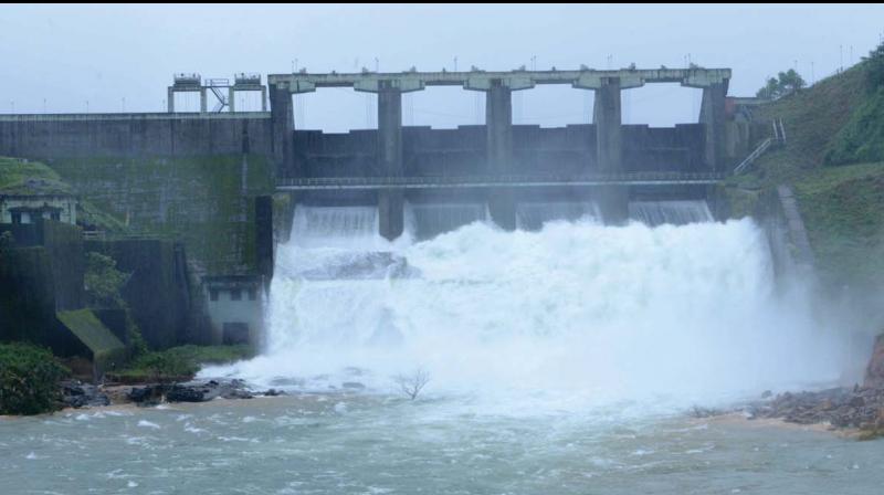
The shutters of Banasura Sagar dam opened further from 235 cm to 265 cm to allow more discharge. The district received 116.14 mm rain in the last 24 hours, and Vythiri taluk recorded the highest of 164 mm.
In Kozhikode district, the Thiruvambadi town flooded due to landslides in Anakkampoyil. At Kannappankundu, where a landslide occurred last week killing many, there were two more minor landslides.
In Malappuram, more than ten labourers of the government-owned Seed Farm at Mundery were isolated as the Chaliyar River flooded on Tuesday.
Munnar stands isolated
The Munnar town got isolated in massive floods as the water level went rising, inundating many of shops and commercial establishments.
The Kochi– Dhanus-hkodi national highway, the Munnar–Udumalpet interstate highway and the Munnar-Aluva national highway, the three major roads connecting Munnar to the outside world, inundated with vehicular traffic paralysed. Water from the Kannimala–Nallathanni rivers flooded the town raising the water level to 50 feet.
Flood water also entered cottages of the estate workers. Shutters of the Mattupetty dam near Munnar was opened on Tuesday morning after the water level reached 1,599.50 feet. The first shutter of the dam was opened at 8.30 am and the second shutter by 1.15 pm.
According to sources, this is the most damaging flood situation Munnar town encountered ever since 1924. According to latest reports, no tourist got trapped, Devikulam Tahsildar P.K.Shaji, told DC.

