Chennai: IMD in a fix over tracking cyclone Gaja course

Chennai: Looks like the weathermen are struggling to track and pinpoint the movement of cyclonic storm ‘Gaja’.
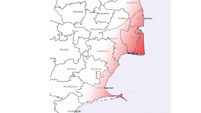
Following the news titled ‘Mixed forecasts on cyclone Gaja’, published in Deccan Chronicle, Chennai edition, on Monday, the Indian Metrological Department (IMD), later in the day, changed its track stating that the storm would make landfall between Cuddalore and Pamban.
The Regional Meteorological Centre (RMC) on Sunday forecast the landfall between Cuddalore and Sriharikota. But, weather bloggers predicted that the cyclone could cross near the Sri Lankan coast.
Dr S. Balachandran, deputy director general of meteorology, RMC, said that the cyclonic storm would make landfall between Cuddalore and Pamban. “As a result, there would be rainfall in most places in the state. Rains would occur in the northern part of the state, Puducherry and adjoining southern parts of the state. There could be heavy to very heavy rains at a few places. Moreover, extremely heavy rain is likely to occur in Thanjavur, Tiruvarur, Nagapattinam, Karaikal, Cuddalore, Pudukkottai and Ramanathapuram districts,” he noted.
As far as wind warning is concerned, squally winds reaching a speed of 45-55 kmph and gusts at 65 kmph is likely to occur along Tamil Nadu and Puducherry, and Puducherry - South Andhra Pradesh coasts from the morning of November 14.
“Wind speed is set to gradually increase and gale like winds with speed 80-90 kmph and gusts at 100 kmph is likely to occur along and off the Tamil Nadu and Puducherry and Puducherry-South Andhra Pradesh coasts from the night of November 15,” the weather expert noted.
Meanwhile, weather bloggers said that the cyclonic storm might weaken and move towards the Sri Lankan coast.
“We are fairly confident that ‘Gaja’ has started its West Southwest movement since the early hours of Monday. The change in cyclone movement has started earlier than what we anticipated. We can possibly expect the landfall to be South of Puducherry or Nagapattinam,” said a city-based weather blogger.
Chances are also high that landfall could be near the Sri Lankan coast, if the cyclone moves towards Southwestwards, he added. “While there is a fair degree of confidence on the broad area of landfall, there still remains a fair bit of ambiguity on how intense the system would be at the time of landfall. This means we may have to wait for some more time to look at potential rainfall estimates due to ‘Gaja’,” the blogger noted.

