Land sharks gobble up Telangana's prime forest area

Hyderabad: The forest department of Telangana is struggling to prevent encroachments, as the encroachment of forest lands are about 4,656 hectares from the last few financial years. The IT wing of the forest department is now gearing up for the new mechanism, because the existing mechanism has some issues that affect the forest department.
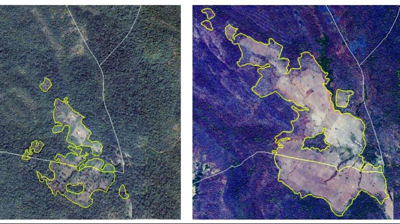
The forest department had earlier signed a memorandum of understanding with the National Remote Sensing Centre to identify the dynamic changes in the forest to curb the encroachments. The pilot project is being taken up at Kothagudem and the forest officials are working on it. The aim is to immediately identify the attempts of encroachments and to immediately respond.
In the financial year of 2013-14, about 1,035.7 hectares of forest land was encroached, in 2014-15 the encroachment was 1,045.512 hectares, in 2015-16 the forest land was encroached over 924.5 hectares and when compared to earlier years, in 2016-17 the encroachment was high as the total forest land encroached was about 1,651.06 hectares. During all these years, the forest department used to get the data once in a year.
The forest department used to get the data of satellite images from the Telangana Remote Sensing Centre every December and then the forest department used to begin the mapping of the whole year. When changes were found in the vegetation during the time of mapping, the officials used to send a team to the detected areas and got a feedback from the ground conducted by the field officers.
As the forest department got the satellite images in December, the changes done the next January would not be recognised until the images of the next year arrived. The forest department is facing trouble with this mechanism.
Speaking to this newspaper, Principal Chief Conservator of Forest (IT), Mr P. Raghuveer said, “The earlier mechanism is a bit slower to identify the encroachments. Now, we are running a pilot project at Kothagudem and we are able to identify the dynamic changes that took place in just four months. This will be reduced to one month soon. But, we are asking the experts to provide the information of encroachments in just five days. They are working on it and a special algorithm should be written for this, so that, the pictures will be immediately identified by the computer without any manual effort.”
He added, “We procure satellite data once a year. Availability of data without clouds interruption for the entire state is mostly post- monsoon in the months of November to January. After the satellite data for a year is received, our scientists in the Geoinformatics cell compare it with the previous year’s satellite data to detect changes in vegetation cover, both positive and negative. With the help of algorithms developed by NRSC we are trying to automate vegetation change detection, which means we can know the changes in vegetation cover on a monthly basis.”

